
A Quick Orientation of Philadelphia
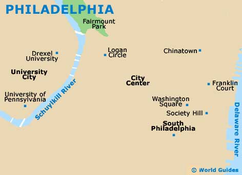
Most of Philadelphia is situated on a tongue of land between the Delaware and Schuylkill rivers. The main district of Philadelphia is the Center City area which almost stretches to both riverbanks. Dominated by the impressive city hall building, which is adorned with a bronze statue of William Penn, this area saw extensive renovations after the American Bicentennial celebrations in 1976. These days, the Center City area is filled with shops and restaurants as well as many of the city's most visited landmarks.
East of the Center City area you will find the Old City area, which is home to a rich array of landmarks and historic buildings. The focus of the Old City area is Independence National Historic Park. This is the most historic square mile in America and is home to many of the nation's most recognisable symbols such as Independence Hall and the Liberty Bell. At the eastern edge of the Old City lies Penn's Landing area, which was where William Penn, the city's founder, first stepped onto the banks of the Delaware River. This historic area has a lovely waterfront park and a number of historic attractions as well as shops and entertainment facilities.
Just southwest of Philadelphia's city centre you will find Rittenhouse Square, which was one of the original city squares and is still surrounded by some old colonial houses as well as modern hotels and apartment buildings. This is a great place for a picnic lunch and a leisurely afternoon. Just south of Center City is the hippest area of Philadelphia - South Street. This area is the playground of the avant-garde and is home to a plethora of cafés, tattoo shops and art galleries. This is a great place for people watching and Philadelphia's hipsters gather here to see and be seen. Another favourite spot of locals and visitors is the Manayuk area, which hosts a wide variety of shopping and dining options. The Italian Market area is a short cab ride or easy walk from Center City Philadelphia and has an eclectic mix of eateries and museums, with the enticing aromas of fresh meats, cheeses and pasta wafting through the air.
United States Map

Map of Philadelphia Area
Useful Philadelphia Links
Guide to Philadelphia - detailed travel guide to Philadelphia, Pennsylvania (PA), USA
Philadelphia International Airport (PHL) - Guide to Philadelphia (PHL) Airport