Boston Maps - Maps Guide to Boston

Boston world-maps-guides.com - world maps guide with Boston Maps - detailed regional, area and city maps of Boston, Massachusetts (MA), USA - Last updated 3/3/2016.

 Boston Car Rental   Hotel Discounts   Flight Discounts


Maps of Boston, Massachusetts (MA), USA


A Quick Orientation of Boston
The city centre of Boston is relatively small, making it ideal for exploration on foot. It offers many walking tours, including extensive tours of the waterfront area. From Government Center Station, try walking across to City Hall Plaza. At City Hall, take a right turn down the stairs to Congress street and onwards to Faneuil Hall.

Behind Faneuil Hall you will come across Marketplace, with its vendors and various eateries. After stopping for refreshment, walk south and cross Atlantic avenue, which will put you in the vicinity of the New England Aquarium and Christopher Columbus Park.

United States Map
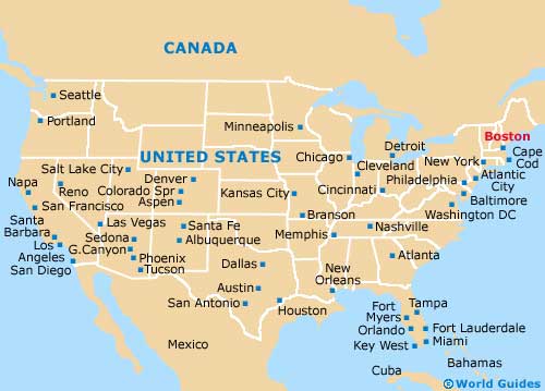
Map of the United States


Useful Boston Links
Guide to Boston - detailed travel guide to Boston, Massachusetts (MA), USA
Boston Logan International Airport (BOS) - Guide to Boston (BOS) Airport


BOSTON WORLD MAPS GUIDES...

Australia Guides

Austria Guides

Belgium Guides

Canada Guides

Channel Islands Guides

China Guides

Czech Republic Guides

Denmark Guides

Egypt Guides

England Guides

Estonia Guides

Finland Guides

France Guides

Germany Guides

Greece Guides

Hungary Guides

Iceland Guides

India Guides

Ireland Guides

Italy Guides

Japan Guides

Mexico Guides

Netherlands Guides

New Zealand Guides

Norway Guides

Poland Guides

Portugal Guides

Russia Guides

Scotland Guides

South Africa Guides

Spain Guides

Sweden Guides

Switzerland Guides

Thailand Guides

USA Guides

Wales Guides


Boston Maps - World Maps Guide to Boston

TravelSmart Ltd: Maps Guides - Copyright 2000-2015 - Boston Maps - Maps Guide to Boston